
Background
The ActiveITS system, developed by Southwest Research Institute, is a sophisticated traffic management solution used across more than 50 deployments nationwide. The system relies on predefined geographical locations to manage and respond to traffic events. However, the process of obtaining and configuring accurate location records has proven to be a significant challenge, especially when dealing with large volumes of data. Manual entry and configuration have shown practical limitations, prompting the need for a more automated and scalable solution. Recent deployments, including a pilot with the New York State Department of Transportation (NYSDOT), highlighted concerns about data reliability and the substantial support required for data formatting. To address these issues and support the expansion of ActiveITS, this research aimed to explore and develop an automated method for generating accurate and reliable location records using open-source geographical data sets.
Approach
The project followed a structured three-phase approach to tackle the challenges associated with generating location data for the ActiveITS system. The first phase involved evaluating potential data sources, with OpenStreetMap (OSM) emerging as the primary choice due to its extensive and freely accessible geographical information. To enhance the geographical context and ensure the validity of the location data, supplementary information from the U.S. Census was also incorporated. In the second phase, the focus shifted to extracting and combining the necessary geographical features from OSM, including ramps, highways, and cross streets. The final phase involved the development of a system for user interaction and data validation. A front end, built with React, was designed to enable users to define geographical bounding boxes for location generation. This input was processed by a Python back end, which queried OSM and generated the corresponding ITS locations. The system was equipped with interactive maps and data tables to allow users to review and customize the location records. The validated data could then be exported in Excel format, ready for integration into the ActiveITS system. This approach guaranteed that the system was both effective and easy to use, simplifying the process of generating and validating location data.
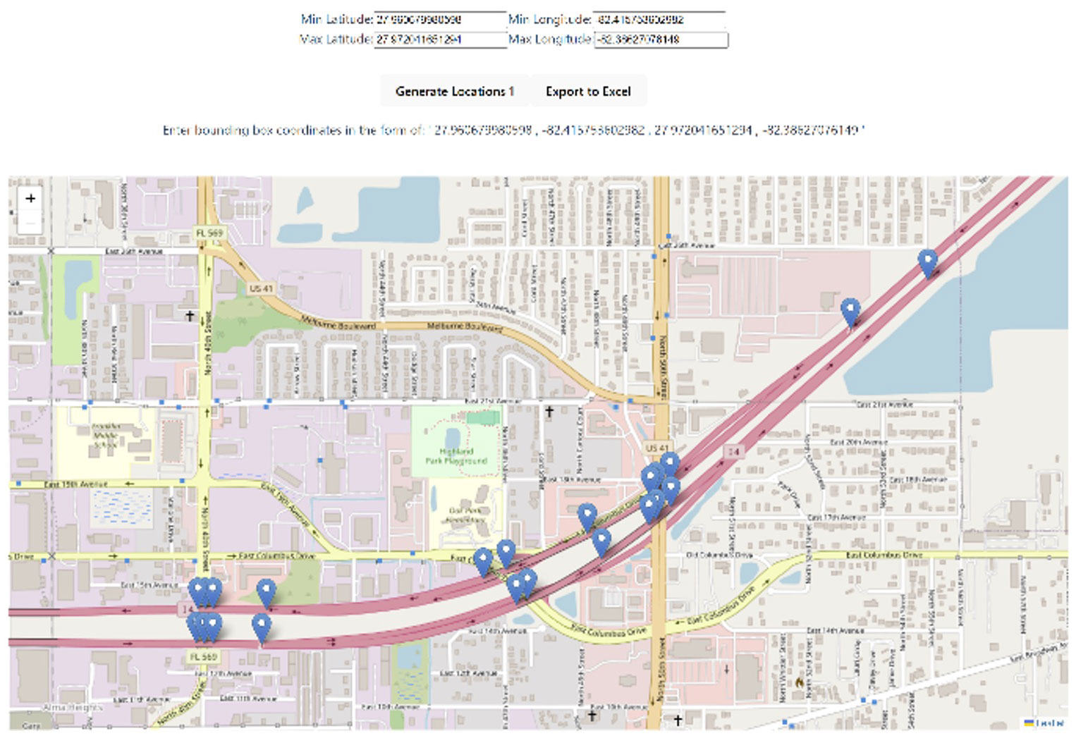
Figure 1: Automatic location generation user interface.

Figure 2: Automatically generated locations imported into an ITS System.
Accomplishments
The project successfully created a system that integrates a React-based front end with a Python back end, streamlining the generation and management of ITS location data. As shown in Figure 1, the user interface enables users to specify a geographical area by entering coordinates in the form of a bounding box. By clicking the "Generate Locations" button, users can automatically generate location records using OSM data, which are then visualized on an interactive map and displayed in a data table. This design allows users to easily review, validate, and customize location data according to specific requirements.
To further enhance usability, the system enables data export in Excel format, which is configured for compatibility with the ActiveITS system. As depicted in Figure 2, these exported records can be successfully imported into an ITS system using the ITS importer tool. The figure illustrates the generated location data correctly loaded into the ITS system, demonstrating the tool’s effectiveness in translating complex geospatial data into actionable inputs.
The system was tested and refined to work with various regional ITS systems across the country. Future enhancements could further simplify deployment and improve accessibility, enabling clients to independently manage and generate location data with greater ease and efficiency. These accomplishments address prior challenges related to data reliability and formatting, enhancing SwRI's ability to support new and existing clients while increasing its competitiveness in future proposals.