
Background
ActiveITS™ and the Regional Integrated Corridor Management System (R-ICMS) support Traffic Management Systems (TMS) in multiple states, offering features like device control and highway incident response. However, drivers typically use third-party apps like Google Maps for detours, which don't consider traffic signal timing or agencies approved detour routes. Integrating real-time data from these apps could enhance traffic management, optimize detour routes, and improve coordination with local traffic and police.
Approach
This research aims to analyze and compare 3rd party navigation data for enhancing traffic management. The first priority was to identify mobile routing applications that meet the project’s goals and criteria for further evaluation. The research team will examine factors such as market penetration and the availability of APIs to ensure the selected applications are relevant, reliable, and capable of integrating with SwRI’s systems. By systematically reviewing available applications, the team aims to establish a pool of viable candidates for deeper analysis, setting the foundation for subsequent research and testing.
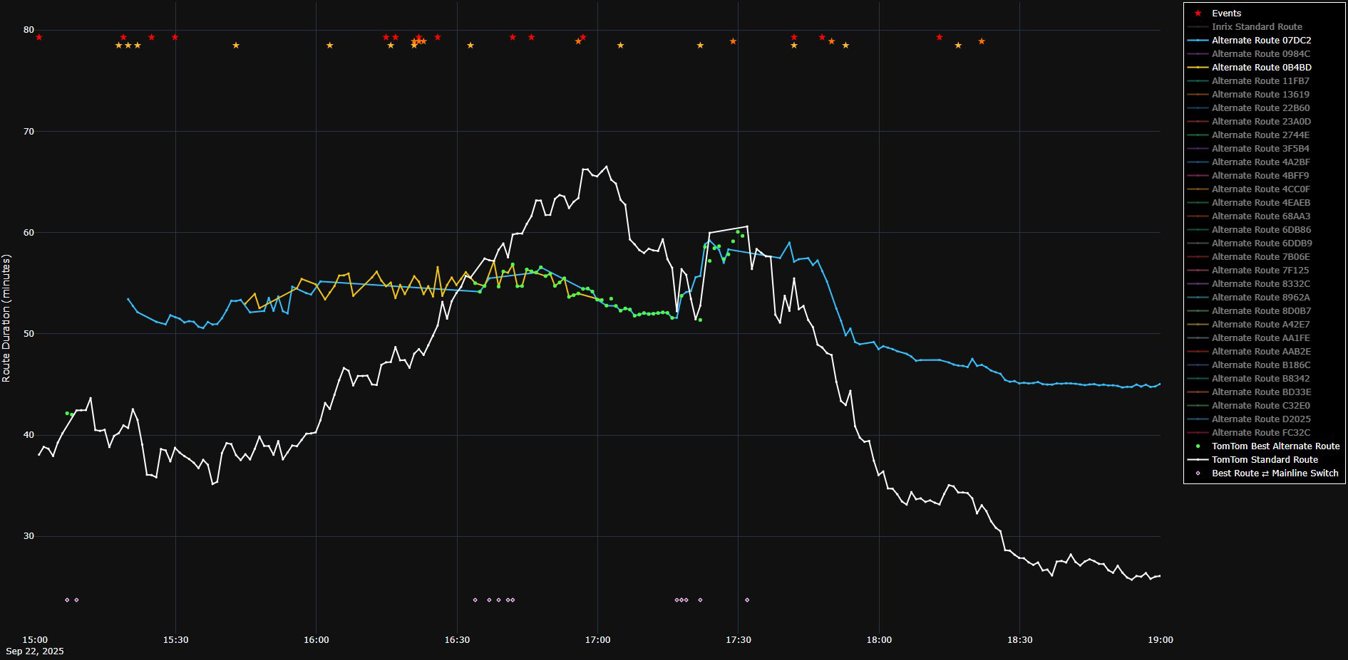
Figure 1: Graph depicting the travel time of routes suggested by TomTom over time during the PM peak in the I-4 Orlando Corridor.
Accomplishments
The research team conducted an evaluation of ten different mapping and navigation applications with publicly available APIs. Based on criteria such as functionality requirements, market penetration, and pricing structures, we narrowed the selection to three providers: TomTom, Apple Maps, and Google Maps. For our case studies, we identified three major roadway corridors: I-35 between San Antonio and Austin, Texas; I-24 in Nashville, Tennessee; and I-4 in Orlando, Florida. Subsequently, we developed an application to query the APIs of these third-party navigation services for routing information. This application continuously collects data on routing recommendations, travel times, and traffic incidents during peak traffic periods. Currently, we are analyzing the results to determine the thresholds for traffic incident metrics and travel times that would necessitate an alternate route suggestion.