
Background
Wildland fires in the United States (US) have been steadily increasing in recent years, causing critical perturbations to the vegetation, destabilizing the intricate web of the soil-vegetation-water dynamics, and altering both the geomorphology and the hydrological response of watersheds, posing significant hazards near the natural-urban interface, municipal water sources, and vulnerable ecosystems. The need for the capability to direct operational fire resources before the fire season begins is growing exponentially, and points to the increasingly important seasonal to sub-seasonal forecasting capacity for wildfires. The prevailing factors determining wildfire risk are the pre-fire-season accumulation of fuels and changing fuel moisture content. Given that the spatial distribution and moisture content of fuels are associated with precipitation and soil moisture conditions in the pre-fire season, such hydrologic parameters are good predictors of fire occurrence and severity, even at seasonal lead times. To understand and quantify the relationship between land surface wetness conditions in the pre-fire period and wildfire occurrence, large-scale data are needed, but such data are difficult to obtain over large domains, and the relationship is largely unquantified.
Approach
The objective of this proposal is to create an innovative, yet robust, hydrology-wildfire modeling framework for the arid and semi-arid regions in the conterminous US west of the Continental Divide, with data assimilation features, and create a long-term dynamic library that links hydrometeorological conditions explicitly to wildfire risk. The technical approach included the following steps: 1) Satellite-based soil moisture, evapotranspiration, vegetation index, total water storage anomalies, as well as thermal anomalies and fire datasets were acquired and processed. Some of these datasets were assimilated in the hydrological or fire model to improve their skill, while others were directly ingested in the dynamic library, 2) The hydrological and fire models were set up and calibrated, 3) A data assimilation module was developed for the hydrologic model, allowing the fusion of satellite-based soil moisture observations with the model’s hydrologic simulations, 4) The coupled (one way) hydrological-fire modeling system was run for an extended period of time (2000-present) and a long-history, queryable, dynamic library of simulated and observed hydrologic conditions and wildfire occurrences and characteristics was created. The system was validated over three spatial domains and periods associated with three different major wildfire events.
Accomplishments
This project resulted in the generation of a ‘look-up’ catalogue that is a straightforward, yet unique, “Early Warning System” that can be used by fire agencies to assist in predicting fire risk conditions and the associated range of hydrologic parameters with acceptable skill up to 30 days in advance, translating into life- and cost-saving. This system, specifically designed for ease-of-use in data-scarce regions, not only enables the development of a simple, yet comprehensive pre-wildfire hydrologic index, but also offers a unique opportunity to understand the intricate interactions between water dynamics and wildfires.
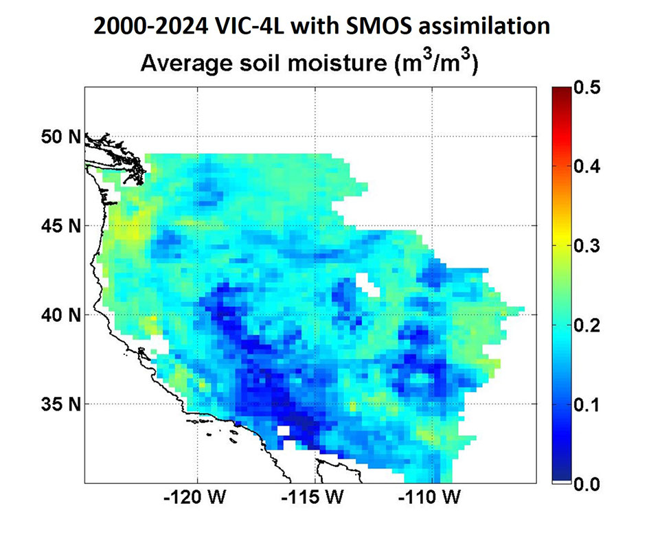
Figure 1: Map of 2000-2024 average soil moisture (m3/m3) derived by the fusion of retrospective hydrologic simulations with satellite soil moisture observations.
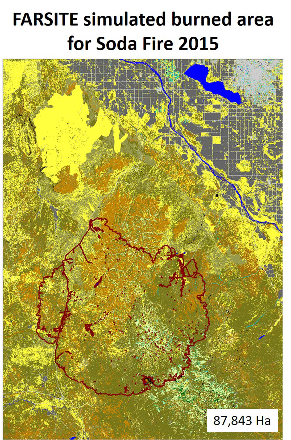
Figure 2: FARSITE-simulated burned area for the Soda Fire that occurred in 2015 just southwest of Boise, Idaho, along the border of southern Idaho and eastern Oregon.